off the map.
this morning at 6:45 i got the negative call from the driver. so i fell back asleep for 2 hours. after waking up i ate a bowl of oatmeal got ready to go and took off to see if i could find the alps.
The other day i had been riding and i was able to see the foot (or so i thought) of one of the nearer mountains. so today i started in that direction. by now (10:00) the calm of the morning had gone and it was getting faily windy. and i had to go into the wind. but i thought it would be fine cause then i would have a tail wind for coming home.
anyways i was able to see the mountain enough to just aim for it and go. i just followed the roads that went towards it for 2 hours or so. eventually i realized i had been going up slightly for a bit. i was in the foothills! so i just kept following the roads going towards the mountain. and most of my pedal strokes taking me higher (there were a few flats or downhills). soon enough there were no more small downhills and i was climbing up up and away. 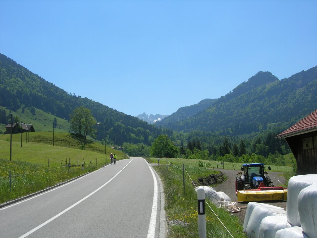
onward and upward!
with the road getting ever steeper. shortly after the steep fields stopped and turned into trees, it got steep. i started to feel the weight of the bag with food and extra water i was carrying (i was not sure if anything would be open). but climbing felt good, even though i stopped to take a few pictures it still was hard work. 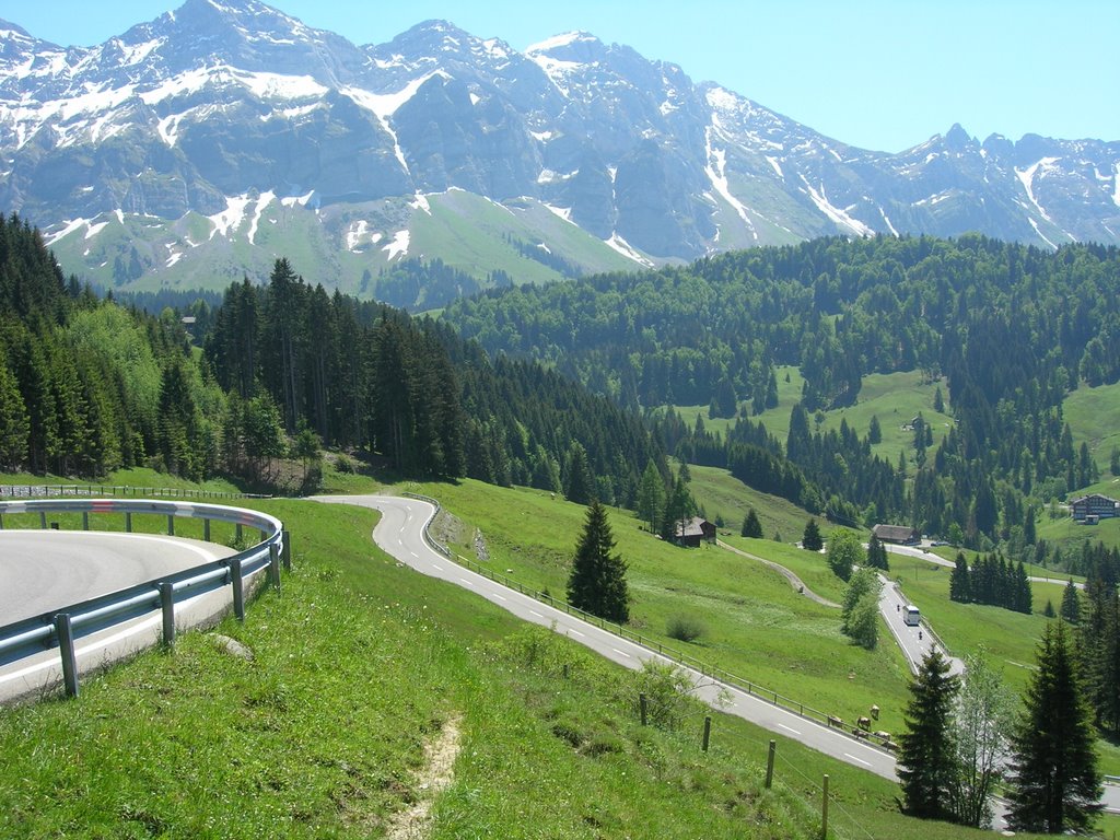
switchbacks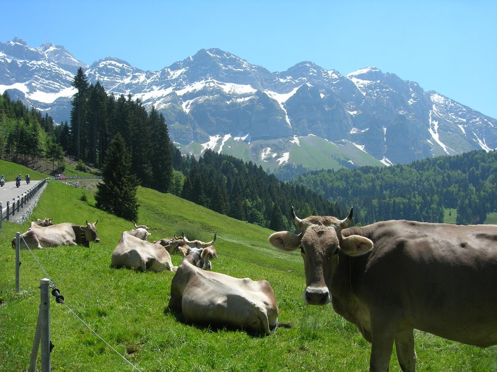
moo.
the steepest part with switchbacks. it does not look to steep but it was.
the steep part (the part i clocked) was 7 km. from the time i started climbing, i have no idea. but i got to bischofzell (the edge of the map) at two hours and reached the top of the road at 3.5 hours. 
just after lunch
on the way up i had seen quite a few bikers going down. and when i got to the chalete/restraunt thing at the top of the road i saw that there must be a marathon ride or something, cause lots of bikers and lots of bikes were eating lunch. i was going to try to get in on that deal, but i noticed they all had tickets...nuts, speghetti would have been good. so i ate a pb-n-j sandwich i had caried up the mountain. i was planning on having lunch when i got to the summit, but there was no road up there. probably becuase the last quite a bit of mountain was cliff, but thats just a guess. i had also want to get above tree line, just because that is fun. but the road just did not go higher, even though the trees stopped not a whole lot higher.
anyways i sat and ate lunch at looked at the mountian. for some reason i did not take any pictures except one of me eating lunch at the high point. i think it was because the mountain would just simply not fit into the viewer, it would have just been a picture of a cliff.
soon after finishing lunch i picked up some snow nearby just to do it, then headed down to the split i took to get to where i was. i decided to go left instead of right (the way i came up) so it was off to new territory (since the two hour mark id been off the map).
down down down i went. wondering the whole time if i should have gone the way i came up. but evenutally i came to an intersection in a city, one way had the name of a city i recognized, the other way went up. i went up. and for quite some time i rode on lightly increasing terrain, when i passed the city called Unterwasser ("under water" translated, even thought it was on the side of the mountain???) the rode increased in steepness and kept going for quite some time. it was now 4.5 hours since departing and i decided to turn around at the top of this hill or 5 hours. the top came first, i stopped and took a little break. i found out that i was on the back side of the mountain i had gone up before. kinda funny, without going over i was on the other side. soon a man came running out of a house below looking up to my position and walking very very fast, i decided it was time to go and went down down down again. this time i paid attention to my speedometer and from the point i had turned in the city it was 12 km. and the road went downwards for another 10 or so before leveling out.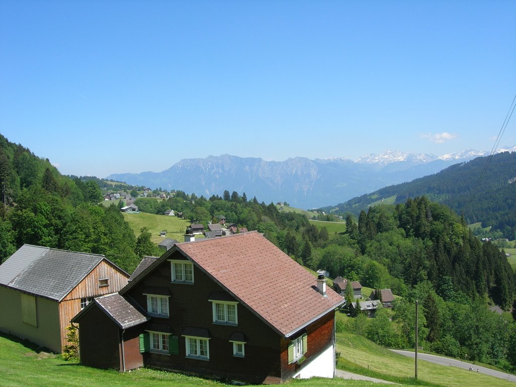
the view from the backside
i was now in Watwil, which was the city name i recognized. or thought i did, i was actually think of Wil, which is on the very bottom of my map. but i just followed the signs to Wil. however once i had gotten out from behind my mountain the wind was coming directly at me with quite some force. this headwind remained with me until i got to konstanz. it was so strong and i was tired, and needed water by this time (6 hours) that i considered hoping a train. i went to the Wil train station and tried to buy a ticket. i could not figure the machine out, so instead i got my water bottles filled. this short stop gave me a new energy and the signs for Konstanz started coming. the first sign said 39 km or so. i had gone just under 160 km at this point so i decided to do 200 km. kinda weird how i went from almost getting on a train, to deciding to push it all the way. but into the headwind and over many 2 or so km hills. and i was back into familiar territory. eventually i made it back to Konstanz, and hit the 200 km mark at exactly 8 hours. i decided for having a headwind whenever i was not going up a mountain, and i was by myself the whole time. it was a decent time. the total gone time was just under 9 hours, so a whole lot of break time. and the highest elevation sign i saw was 1300 m, but lunch was above that. the lake is at 398m.
once i got home i ate a bit. showered, then ate the equivalent of two regular dinners. and i still am not completely full.
that was my day not at the races, kinda sad though, i felt great for the first 5 hours or so, i think i would have done well at the race...but it was a good adventure, and something i wanted to do before i left. overall i have no idea of the total amount of climbing, but if coming down from Unterwasser was 20some km. and that was lower than the lunch break. who knows...
![]()


2 comments:
Nice, capital job Jake, did you carry that Pedro's pouch over your shoulder the entire time?
Nice Kit!
Post a Comment